Log in
All resources
Create a design
11,660 Free Images of Old Map
fonds ancely - bibliothèque municipale de toulouse - maps
maps made in the 18th century
atlantis magni tomus tertius (biblioteca comunale di trento)
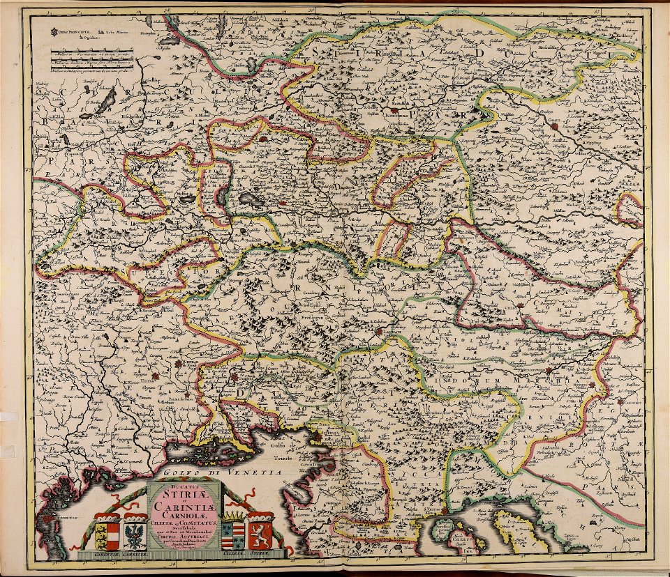
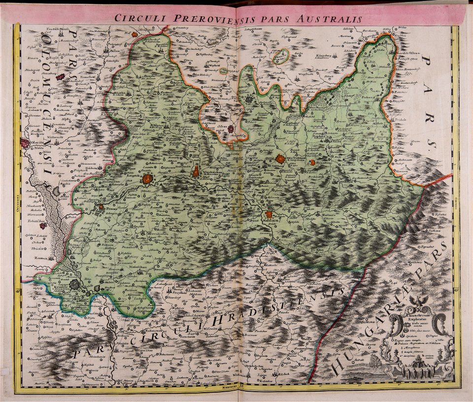
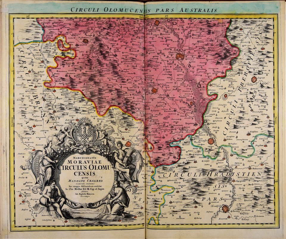
maps made in the 17th century
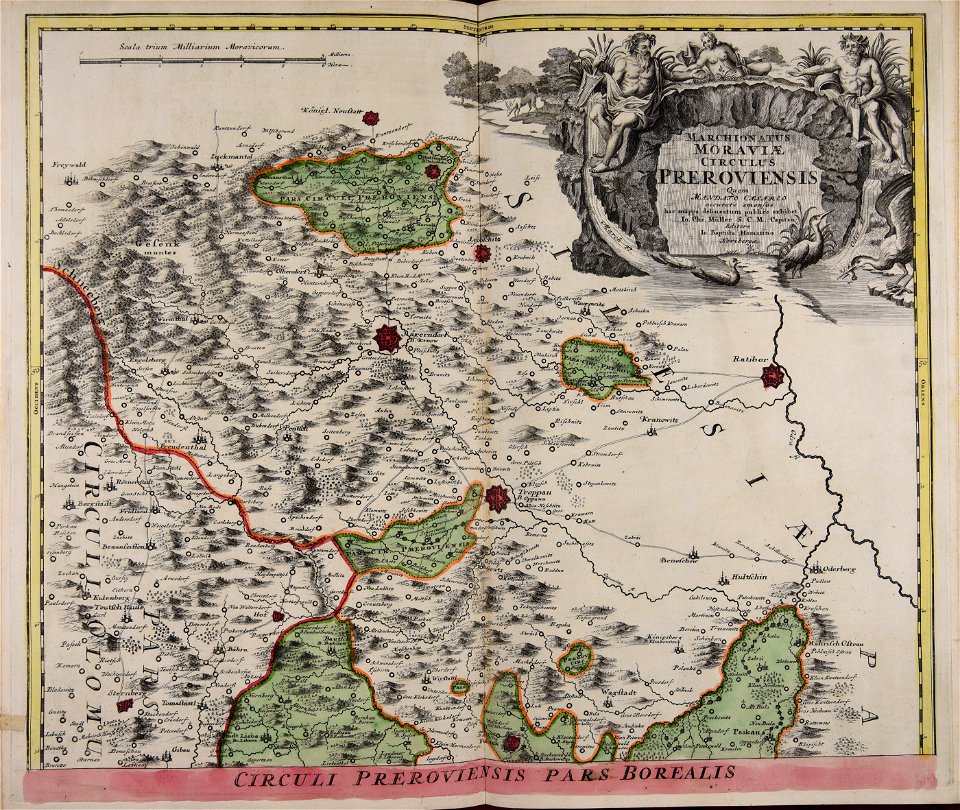
johann baptist homann
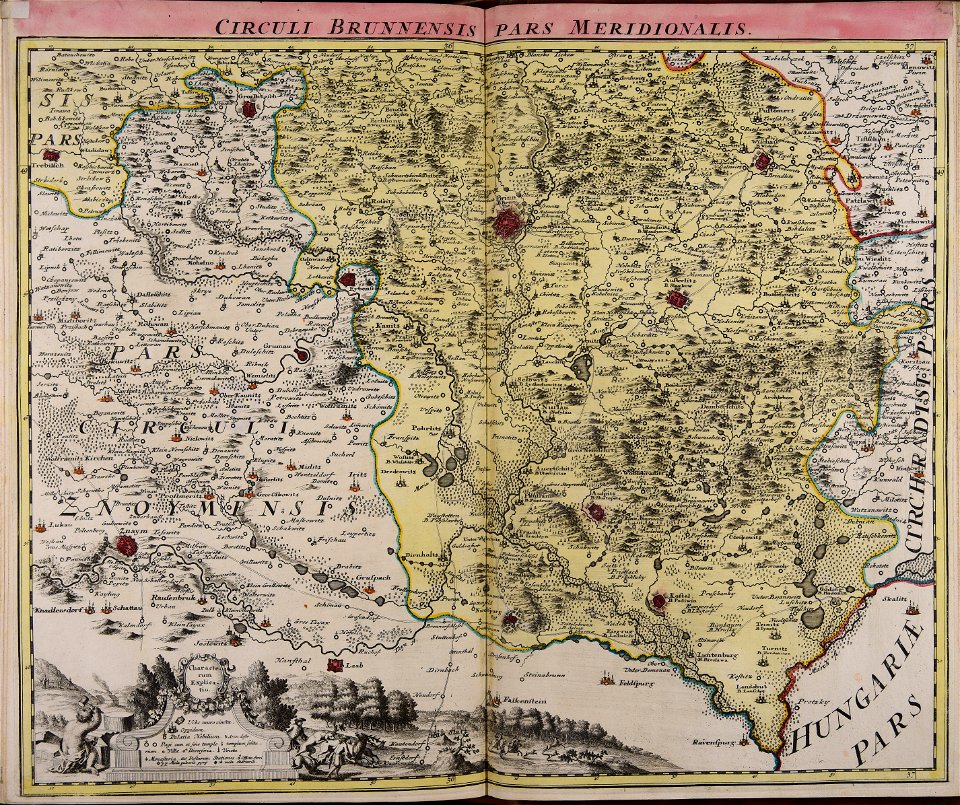
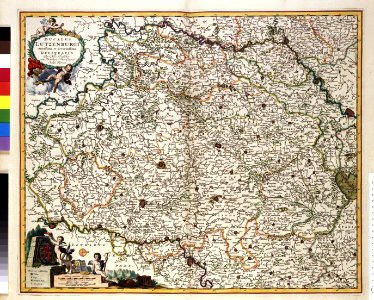
old maps of moravia
johann christoph müller
geographical illustrations by coronelli
maps with cartouches
atlas van der hagen
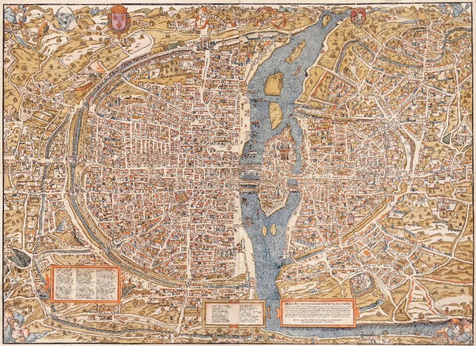
paris
maps
maps with cartouches
atlas van der hagen
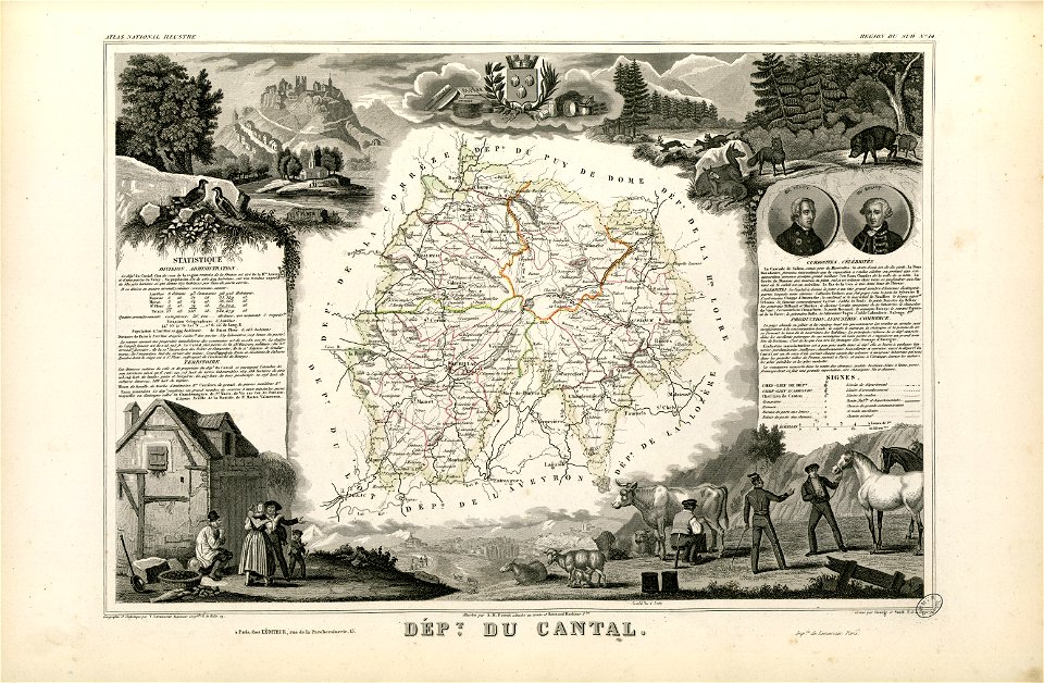
coats of arms of cities in cantal
pierre laurent buirette de belloy
fonds ancely - bibliothèque municipale de toulouse - maps
louis-marie de la révellière-lépeaux
fonds ancely - bibliothèque municipale de toulouse - maps
frédéric-auguste laguillermie
textures
maps
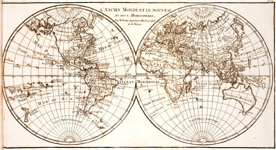
world map
project
maps made in the 18th century
gerard valck
maps with cartouches
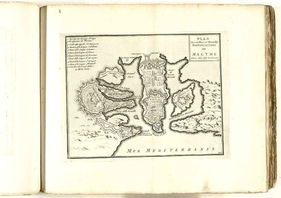
old maps of malta
maps made in the 17th century
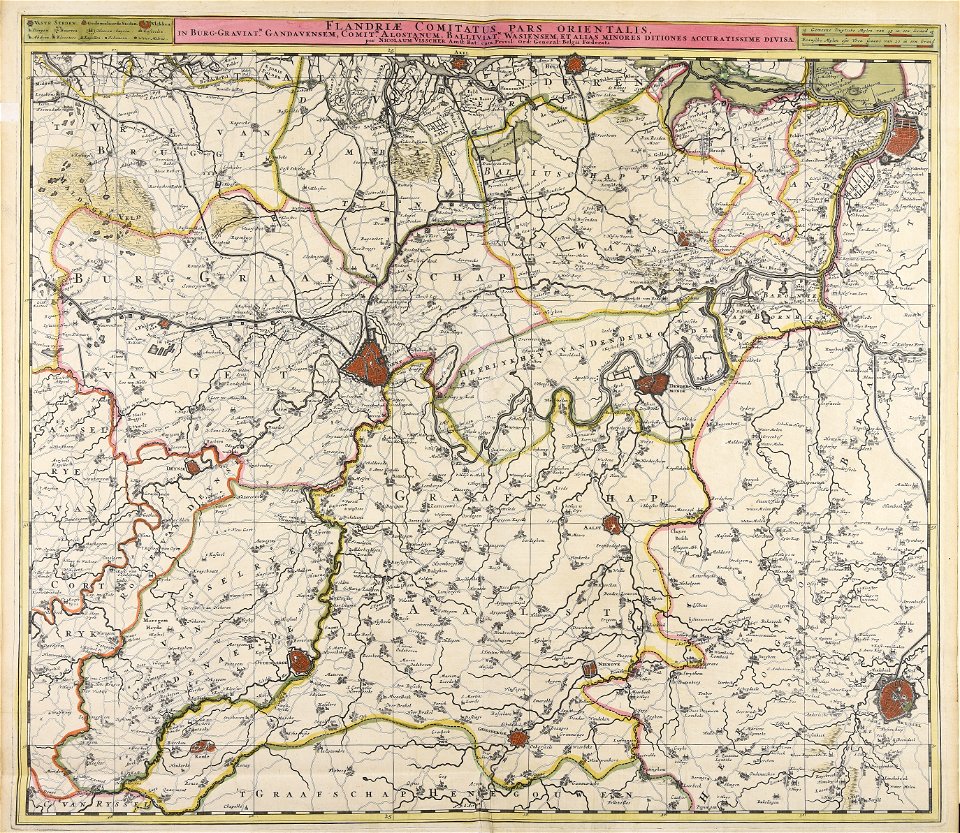
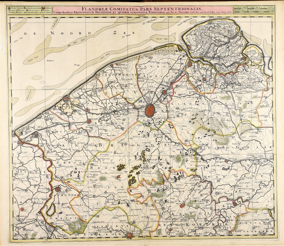
nicolaes visscher ii
maps made in the 17th century
nicolaes visscher ii
prints from the peace palace library
utrecht in the 18th century
atlantis magni tomus quartus (biblioteca comunale di trento)
maps made in the 17th century
maps made in the 18th century
johann baptist homann
maps made in the 17th century
cornelis danckerts (ii)
middle ages in france
alexandre du mège
massachusetts
eastham
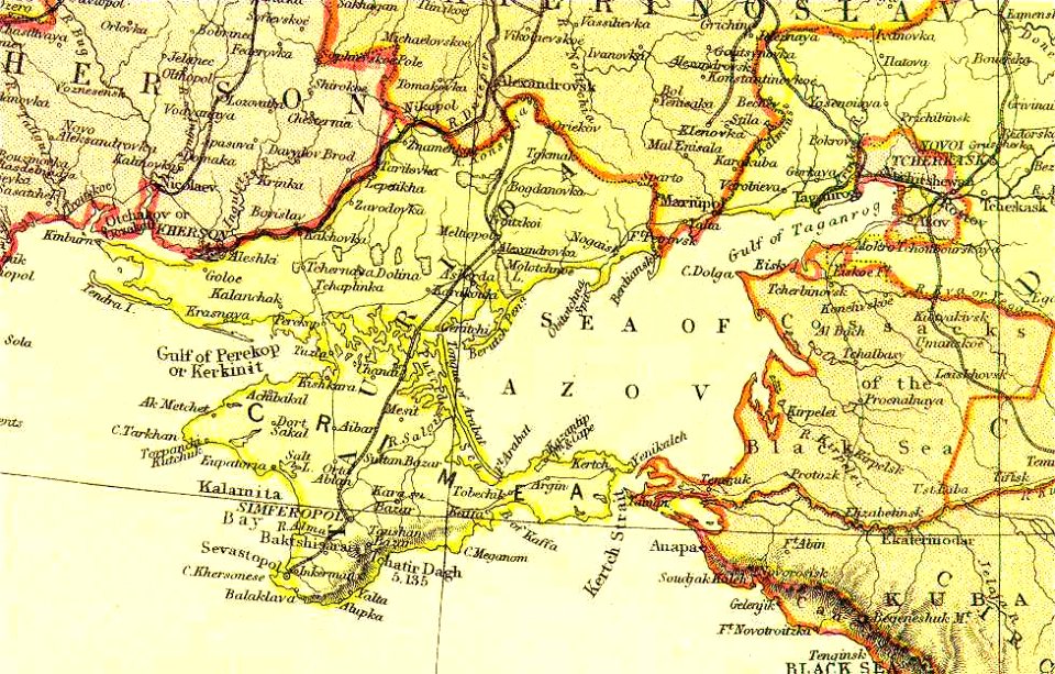
old maps of crimea
sea of azov
maps made in the 18th century
johann baptist homann
maps made in the 18th century
johann baptist homann
maps made in the 18th century
johann baptist homann
fonds ancely - bibliothèque municipale de toulouse - maps
historical images of pau
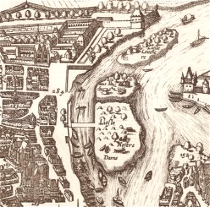
old maps of île de la cité
île saint-louis
maps made in the 17th century
nicolaes visscher ii
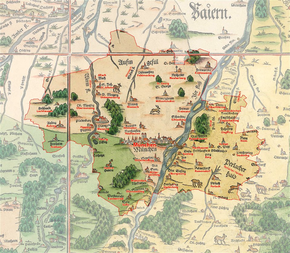
munich in the 19th century
old city maps of munich
prints from the peace palace library
lucan
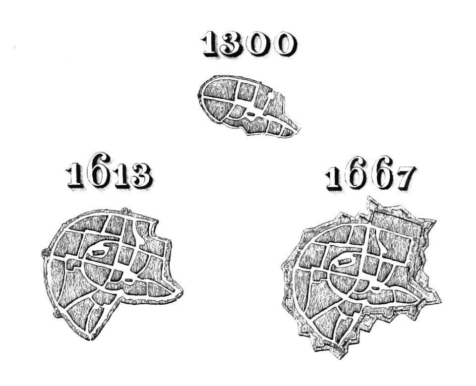
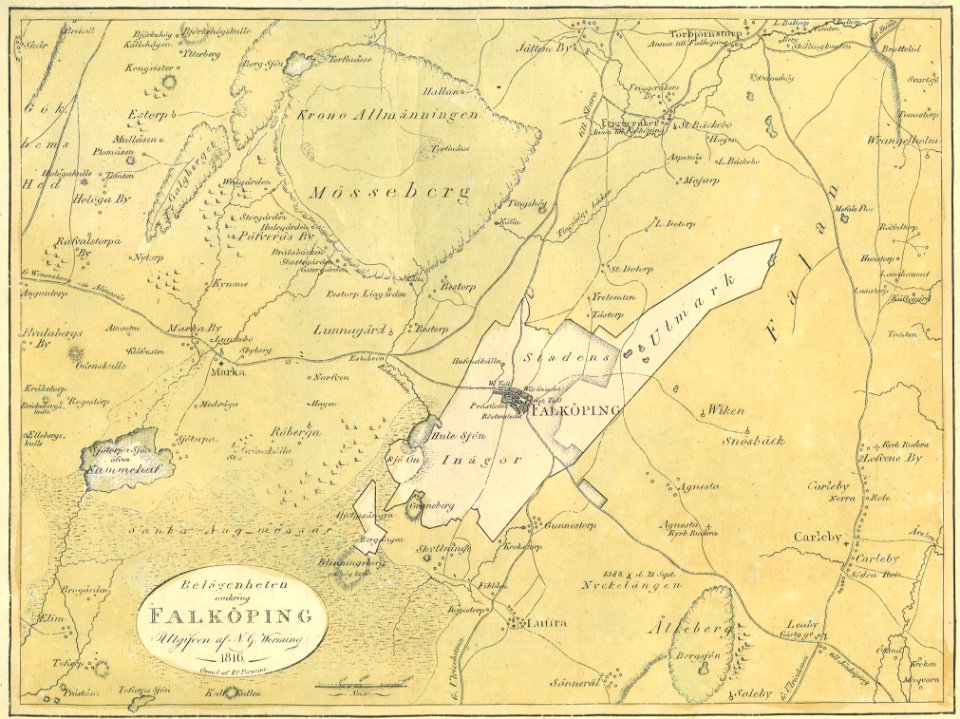
old maps of falköping
maps of falköping
maps with cartouches
atlas van der hagen
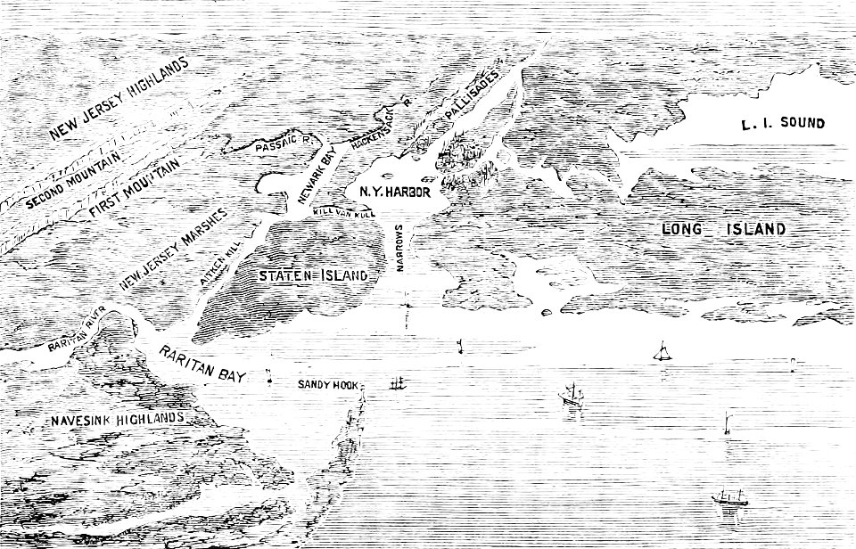
old maps of new york (state)
the palisades (hudson river)
maps made in the 18th century
gerard valck
maps made in the 18th century
johann baptist homann
maps made in the 18th century
johann baptist homann
illustrations of cosmographia (münster)
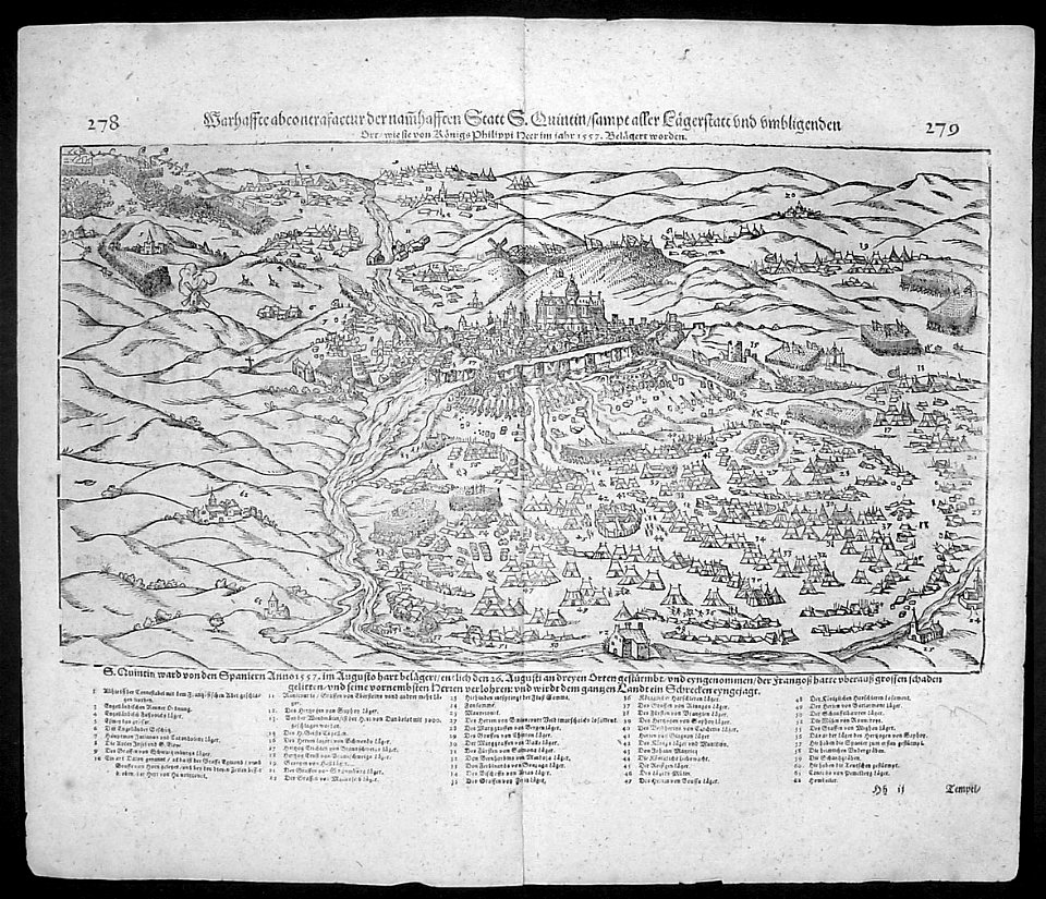
battles in art
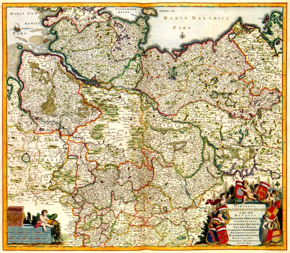
engravings of topographia saxoniae inferioris
hildesheim in art
geographical illustrations by coronelli
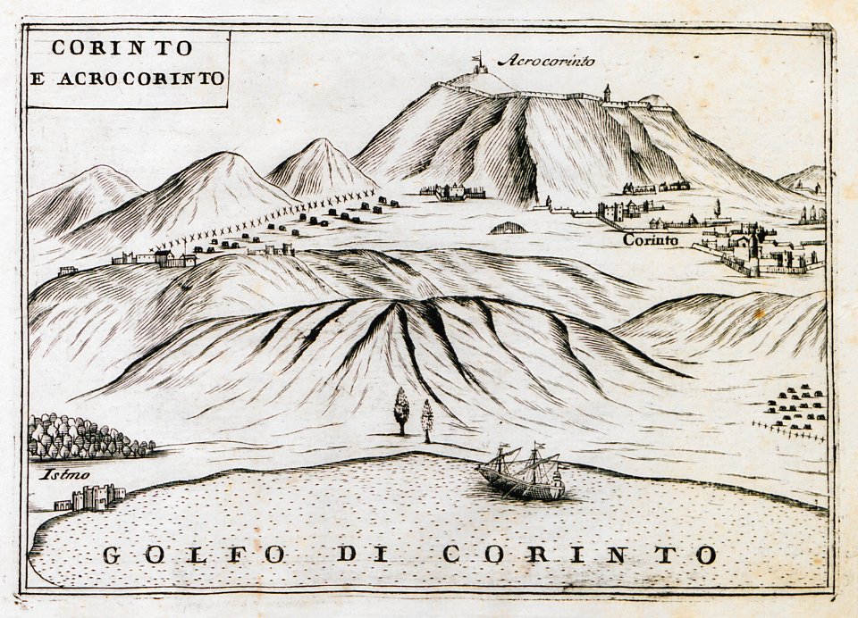
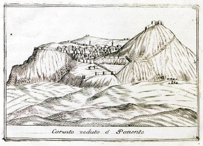
remote views of acrocorinth
geographical illustrations by coronelli
remote views of acrocorinth
collections of the musée jean-frédéric oberlin
ban de la roche
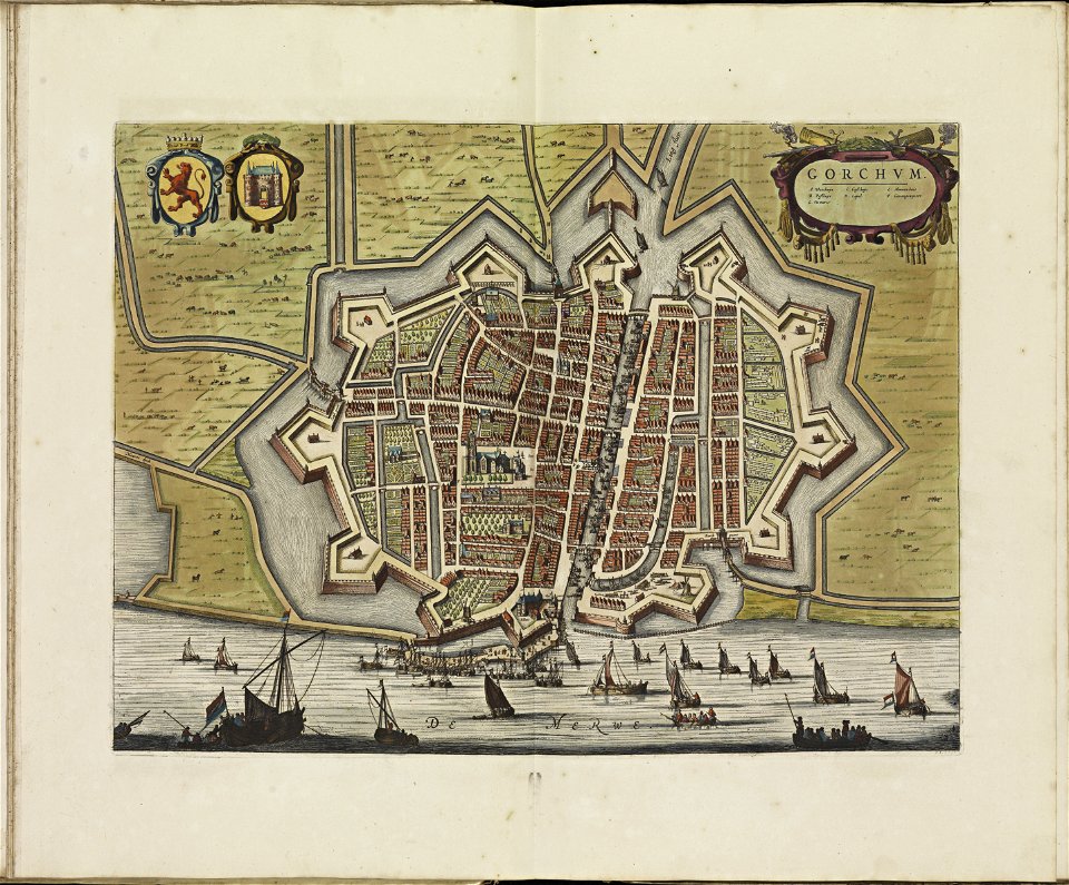
old maps of gorinchem
atlas de wit 1698
files from the bodleian libraries
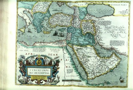
old maps of the middle east
bisset's magnificent guide (1808 edition)
old maps of birmingham
siege of the acropolis (1687)
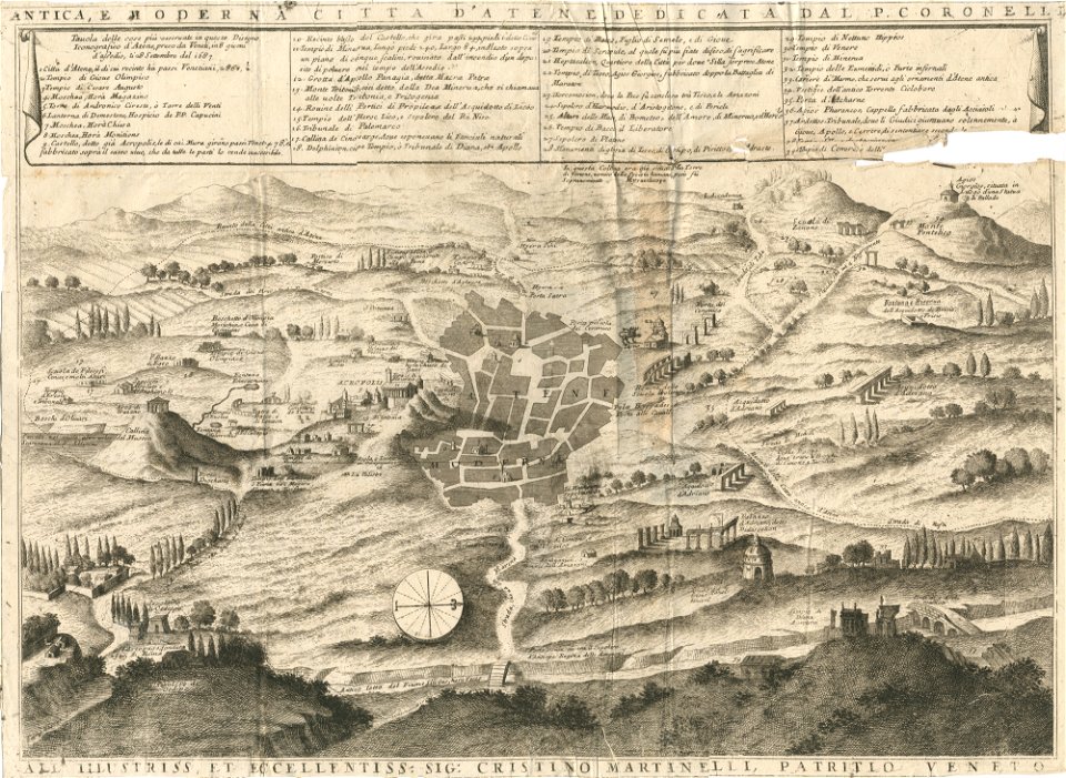
old maps of athens
files from the bodleian libraries
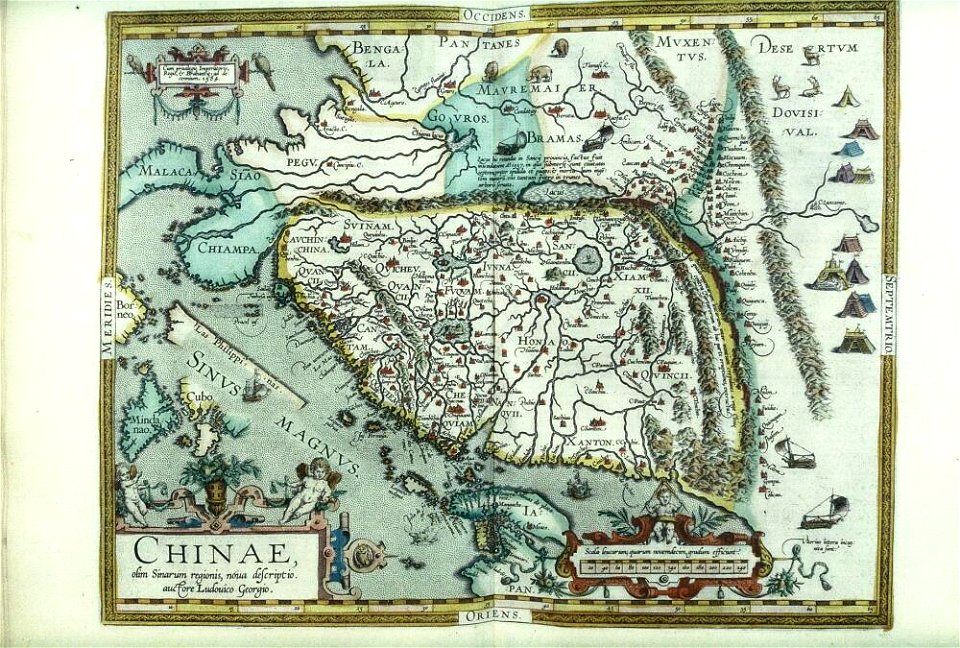
old maps of china
geographical illustrations by coronelli
old maps of athens
old maps of greece
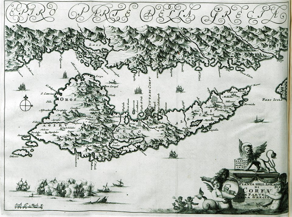
corfu
snippets of philipp apian's bairische landtafeln
old city maps of munich
historical images of minsk
minsk in the 19th century
engravings by matthäus merian
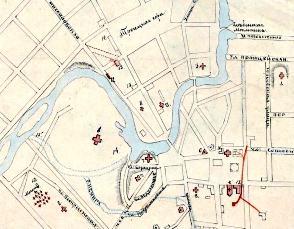
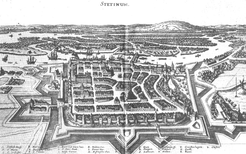
szczecin
maps by george h. walker and company
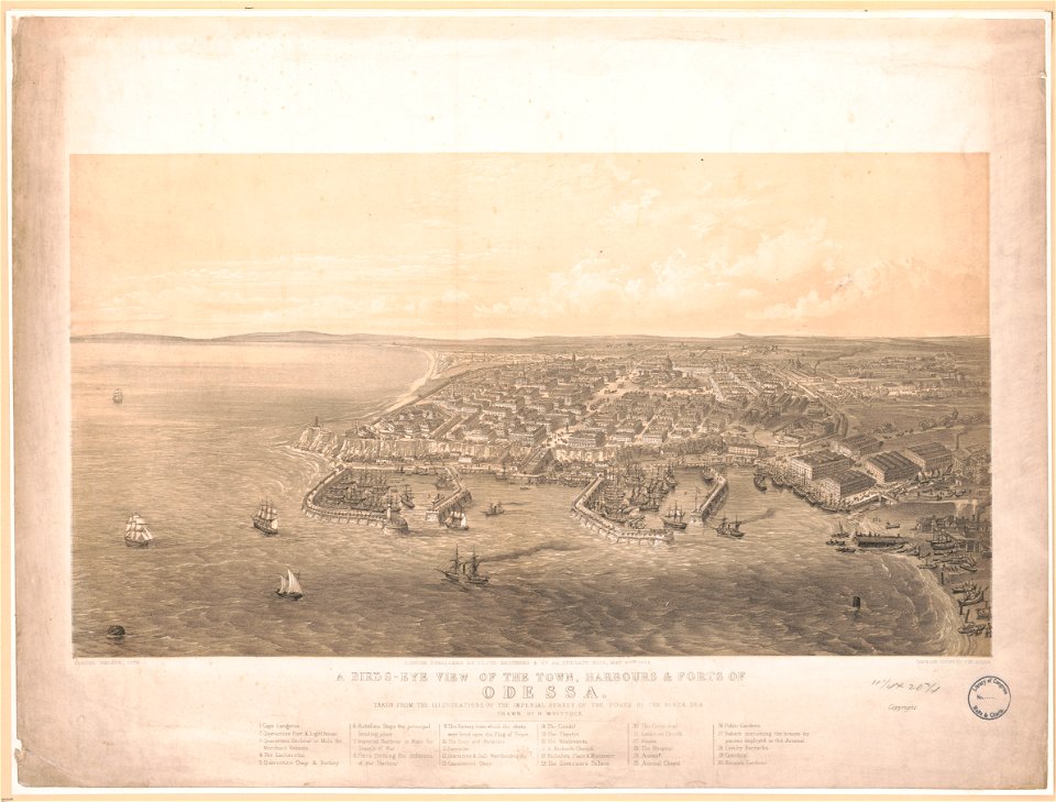
history of odessa
background
maps
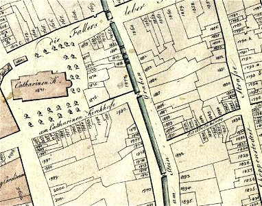
collections of stadtarchiv braunschweig
old maps of braunschweig
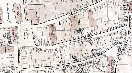
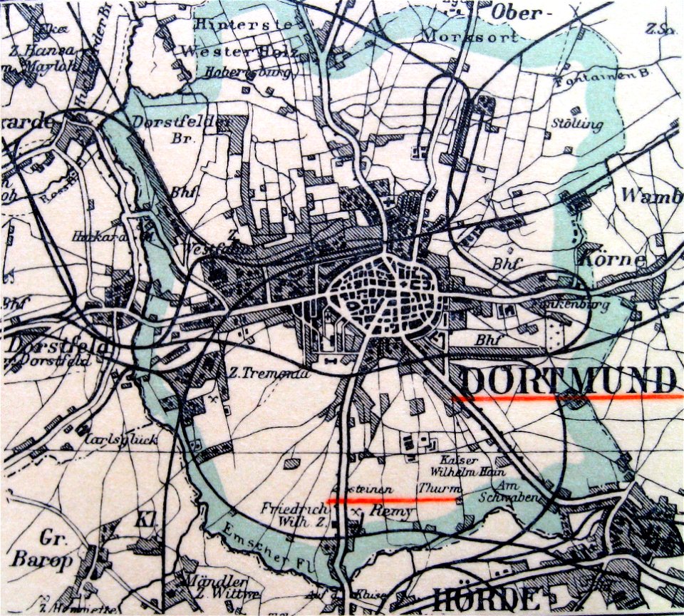
die bau- und kunstdenkmäler von westfalen
kreis dortmund-stadt
great siege of malta paintings at the royal museums greenwich
old maps of valletta
old maps of valletta
joan blaeu
atlas schoemaker
oldenzaal
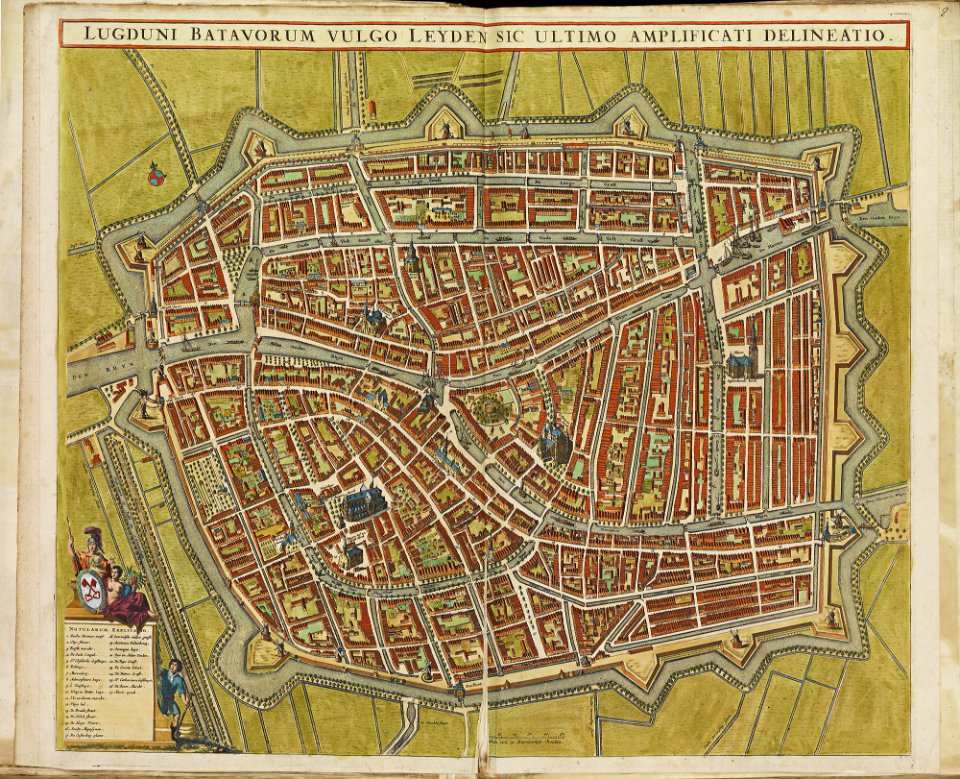
old maps of leiden
atlas de wit 1698
book illustration
old map
kutepov's hunting - illustrations (volume 1)
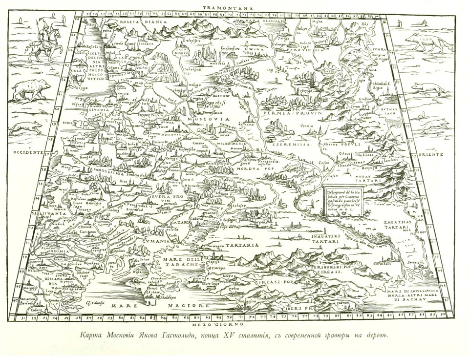
old maps of the tsardom of russia
bibliothèque municipale de reims
rès. g 153
prints from isaak tirion hedendaegsche historie at the peace palace library
old maps of heusden
prints from the peace palace library
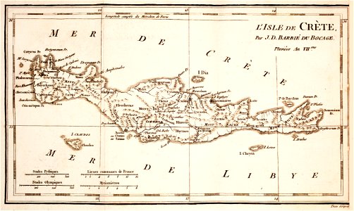
old maps of crete
engravings of topographia saxoniae inferioris
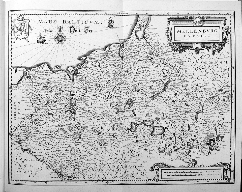
old maps of mecklenburg
historical images of minsk
minsk
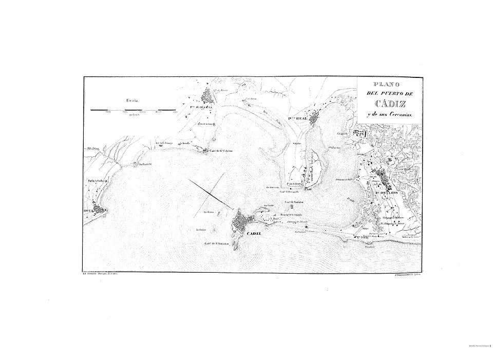
cádiz in the 19th century
1812
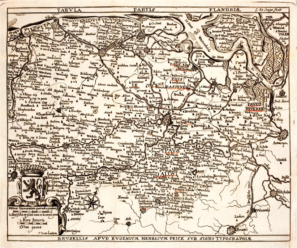
prints from the peace palace library
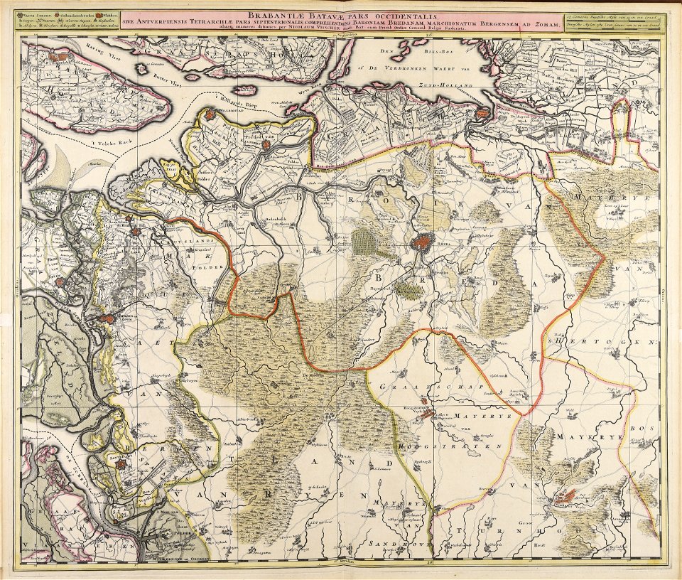
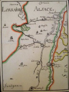
old maps of flanders
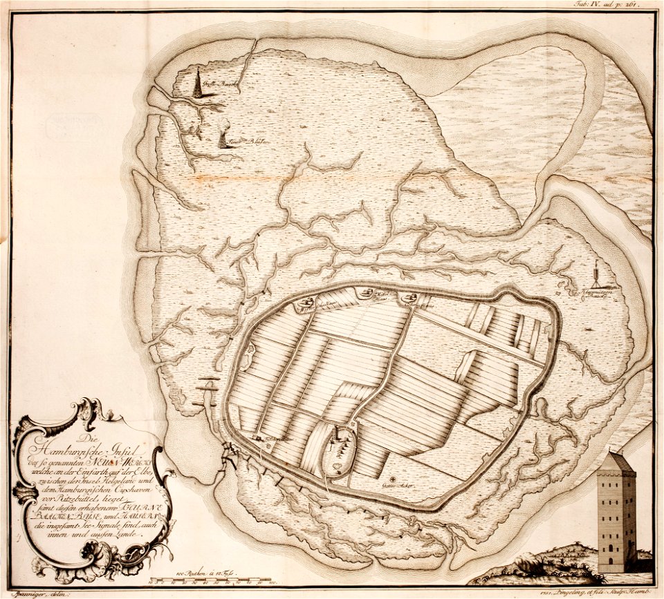
thomas albrecht pingeling
old maps of neuwerk
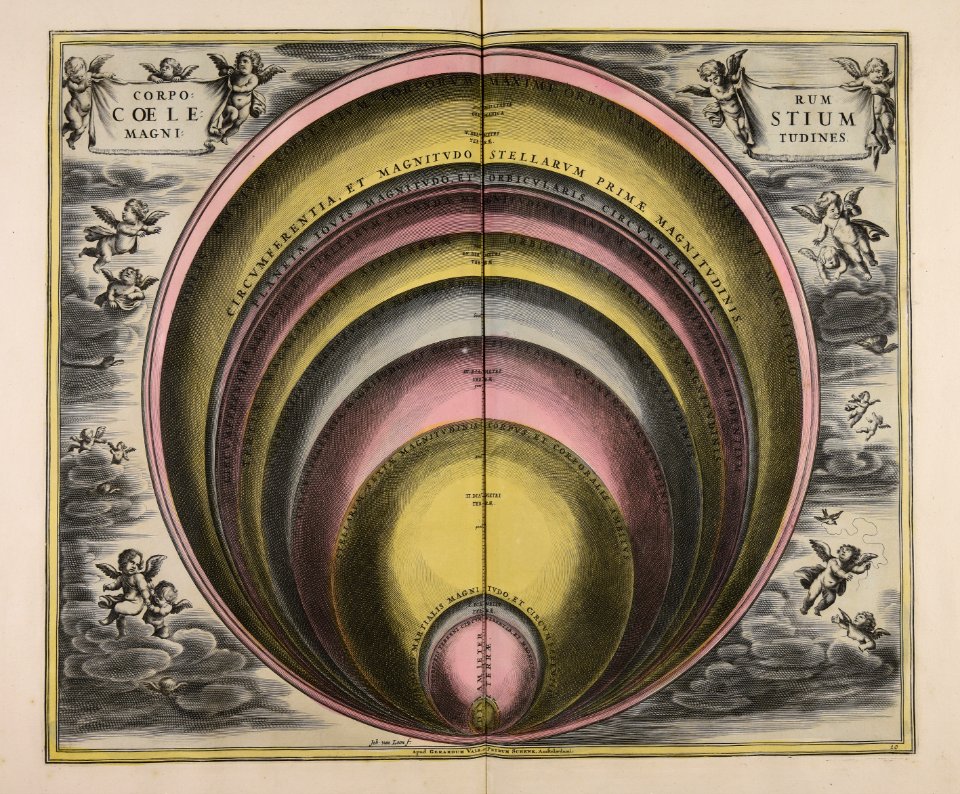
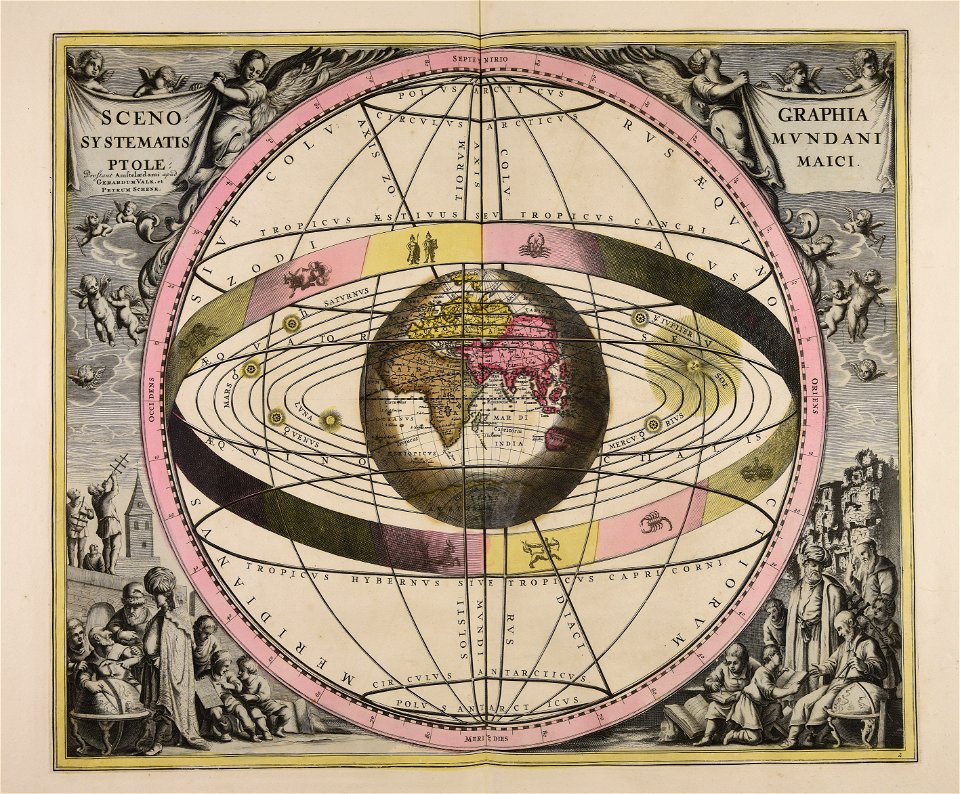
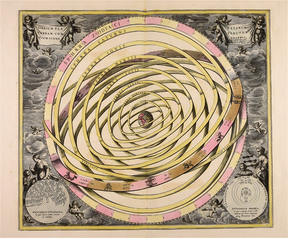
sistema solar
gerard valck
maps in the royal collection of the united kingdom
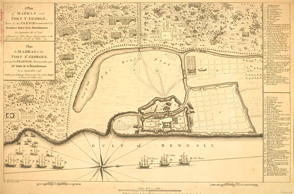
1746
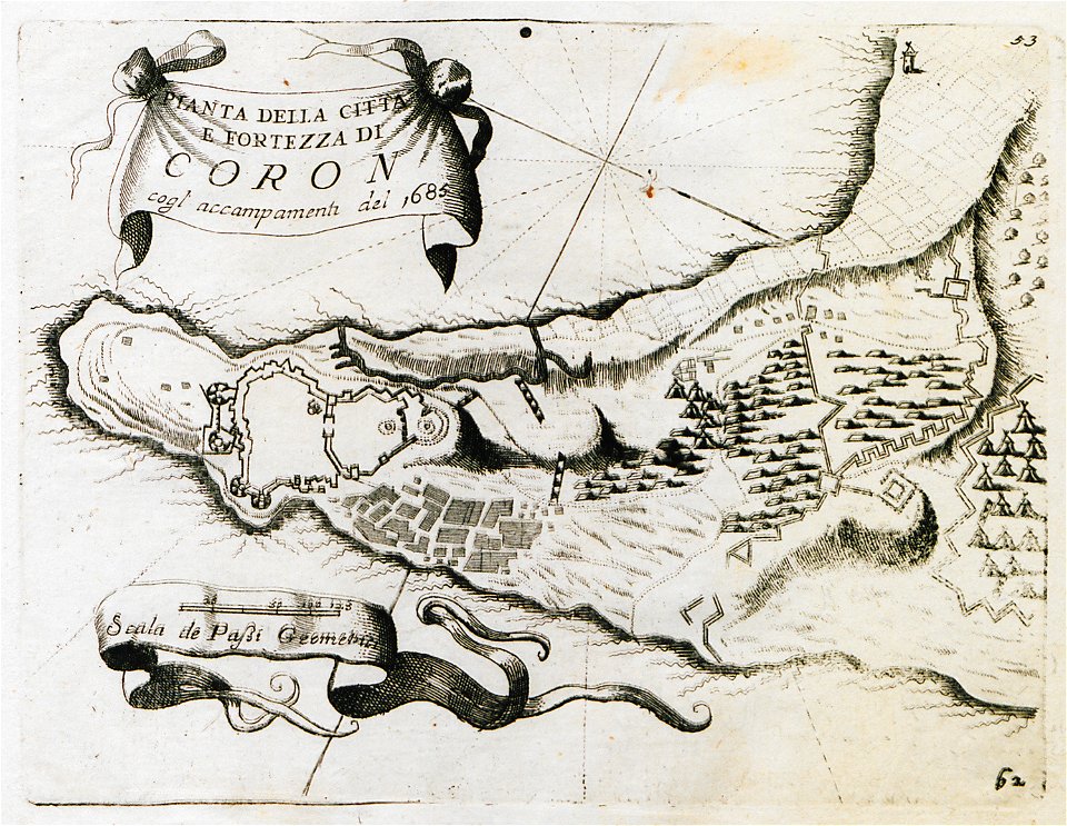
geographical illustrations by coronelli
koroni
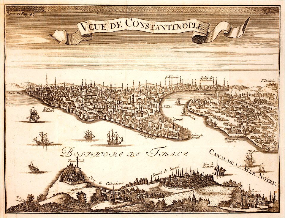
prints from marana espion turc at the peace palace library
old maps of constantinople
geographical illustrations by coronelli
old maps of corfu
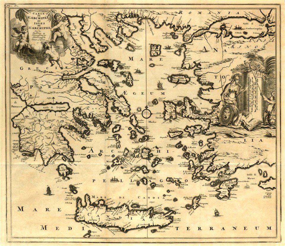
old maps of the aegean sea
harvard university
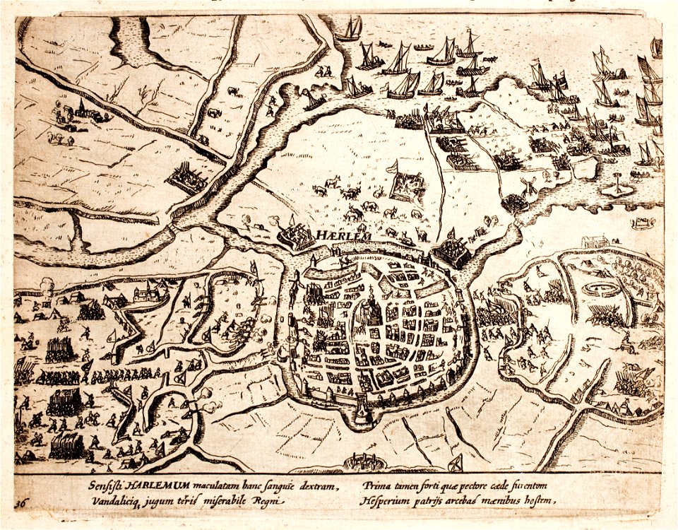
history of haarlem
siege of haarlem
1909 la ilustración española y americana
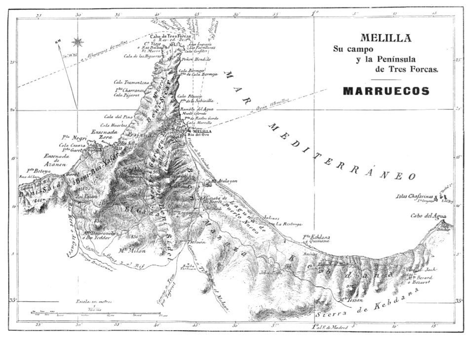
old maps of melilla
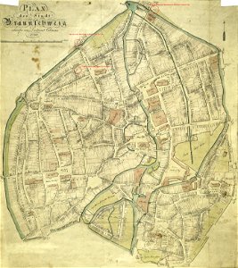
collections of stadtarchiv braunschweig
old maps of braunschweig
collections of stadtarchiv braunschweig
old maps of braunschweig
prints from selden mare clausum at the peace palace library
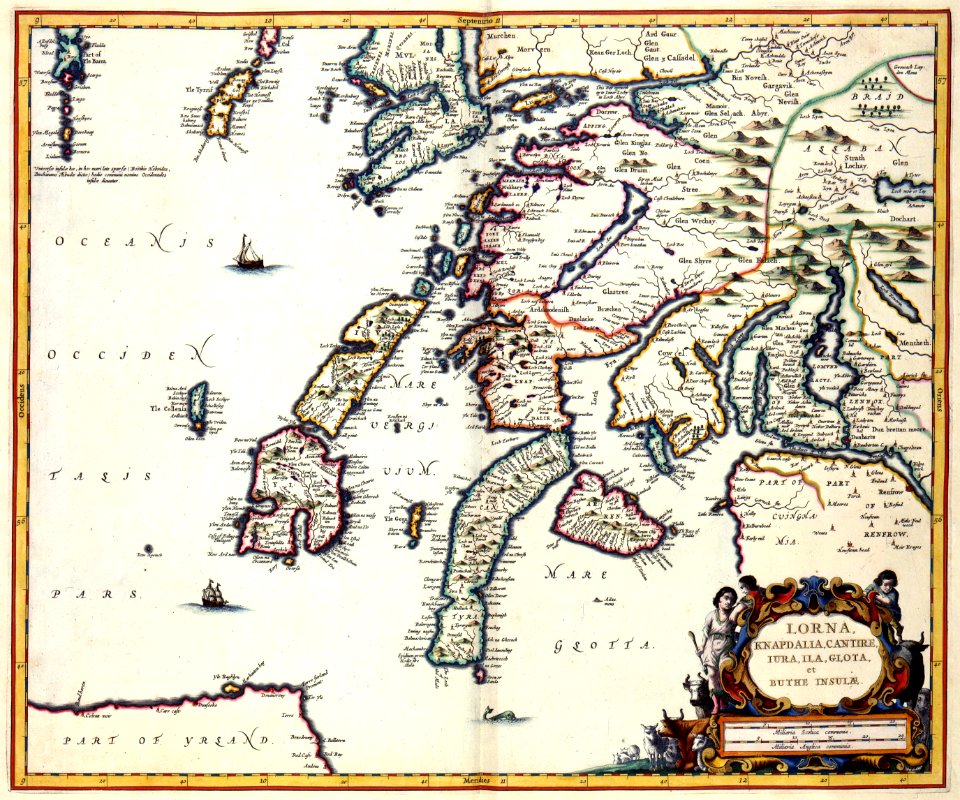
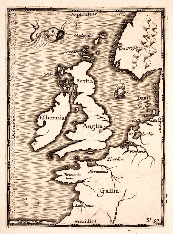
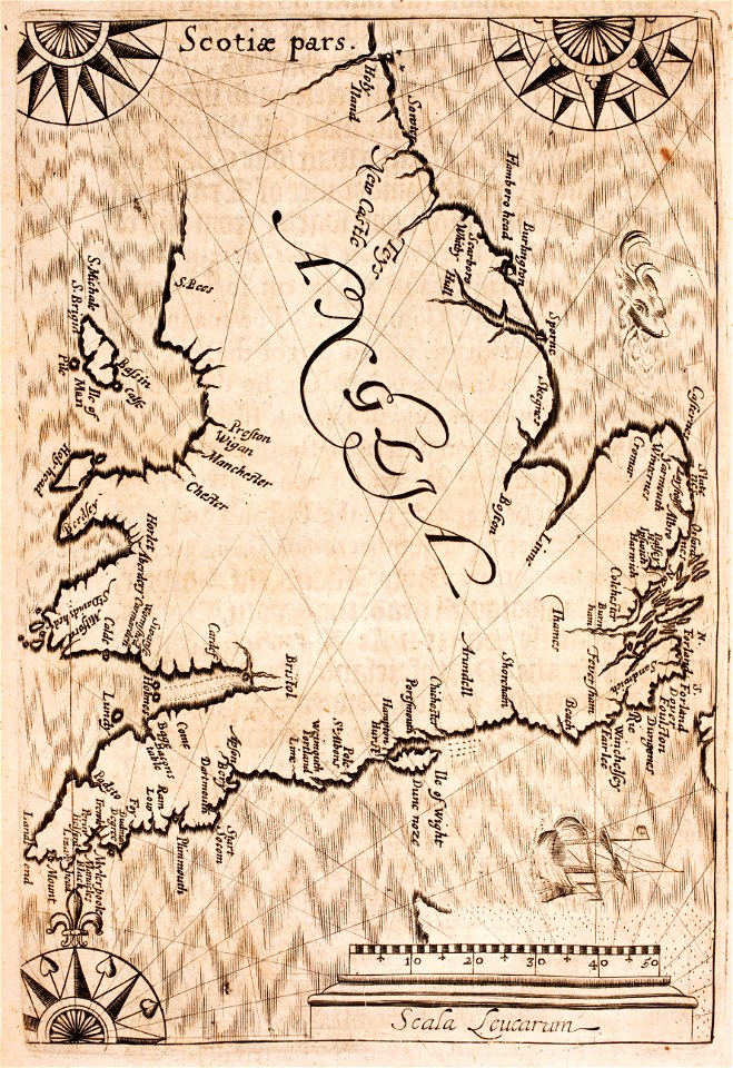
old maps of the british isles
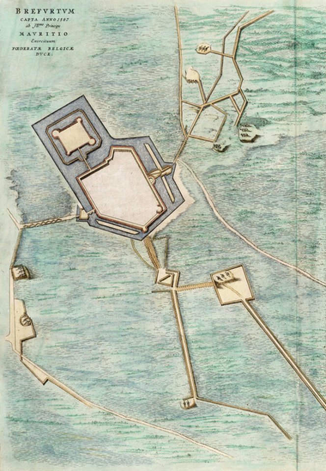
old maps of bredevoort
atlas van loon
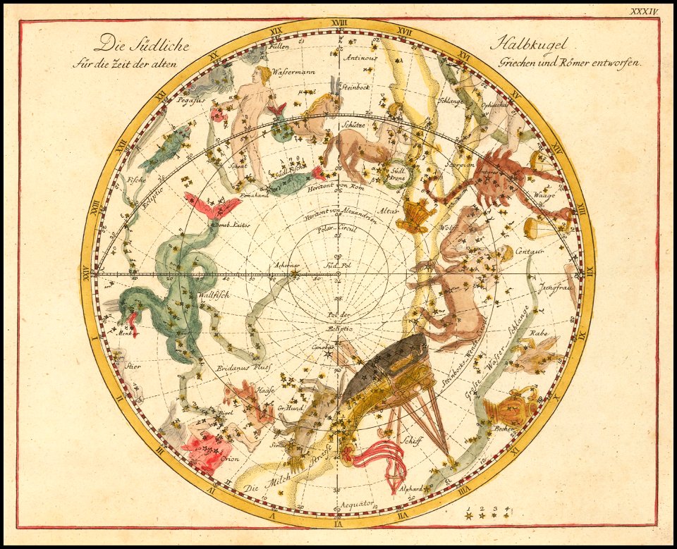
old celestial maps
johann elert bode
old maps of gelre (geldern)
atlas de wit 1698
geographical illustrations by coronelli
athens in the ottoman era
old maps of bologna
bologna in art
prints from the peace palace library
1652
volume 5 of le tour du monde
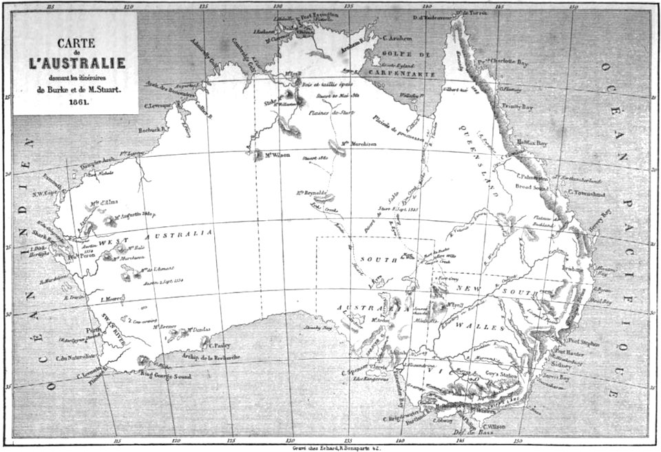
old maps of australia
bibliothèque municipale de reims
rès. g 153
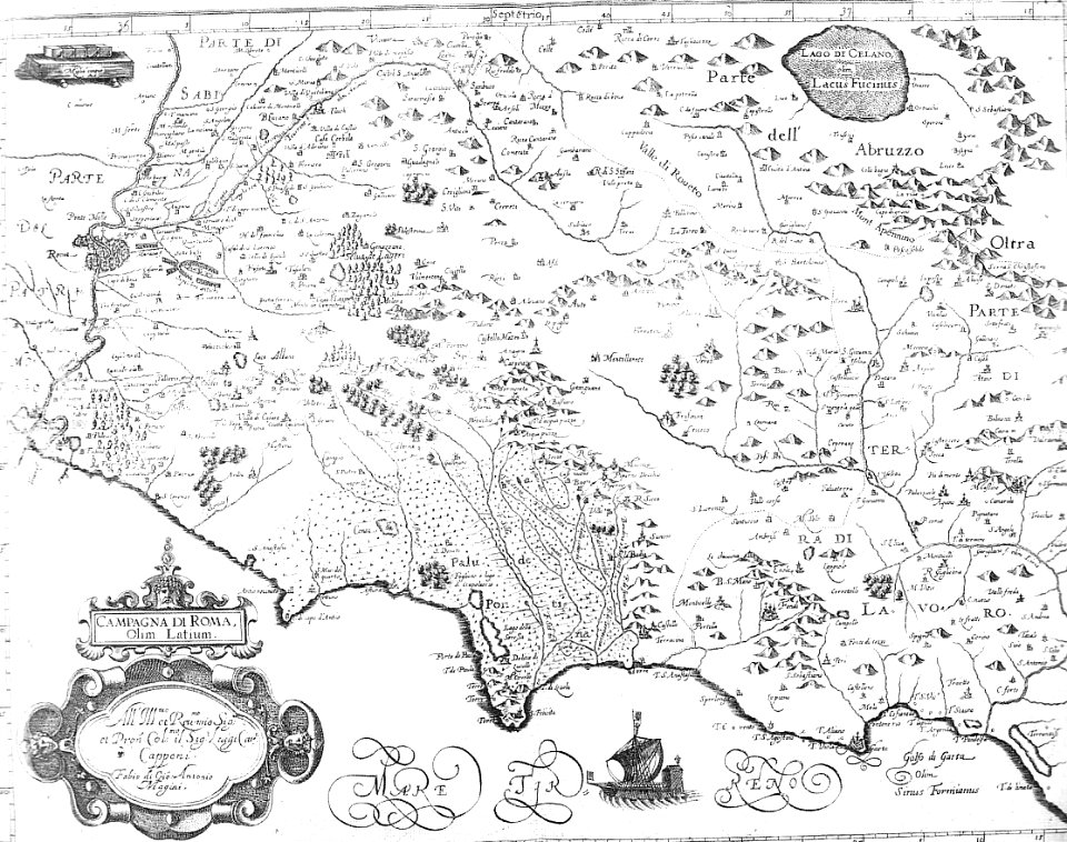
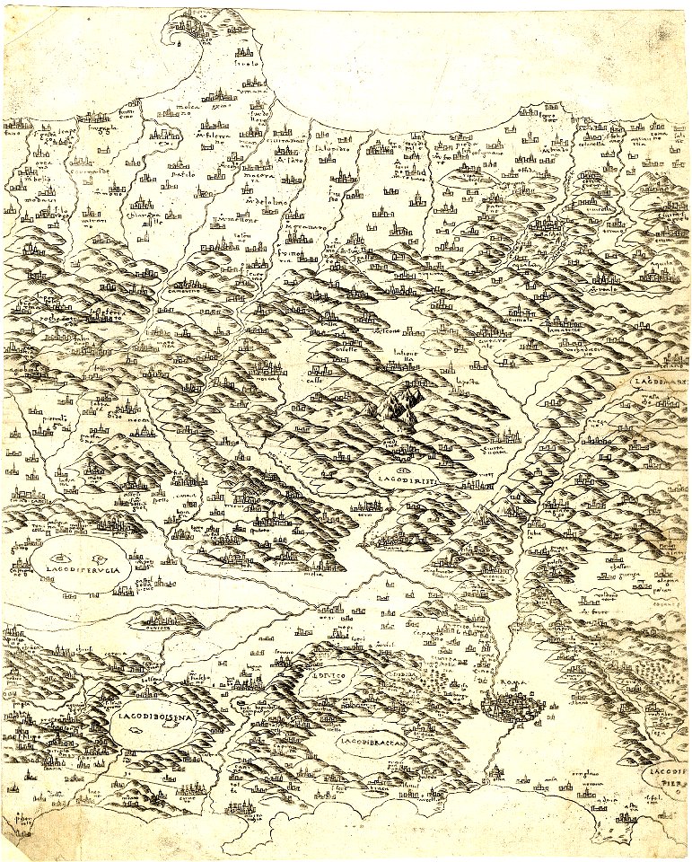
old maps of roman campagna
old maps of lazio
atlas van der hagen (volume 4)
maps with cartouches
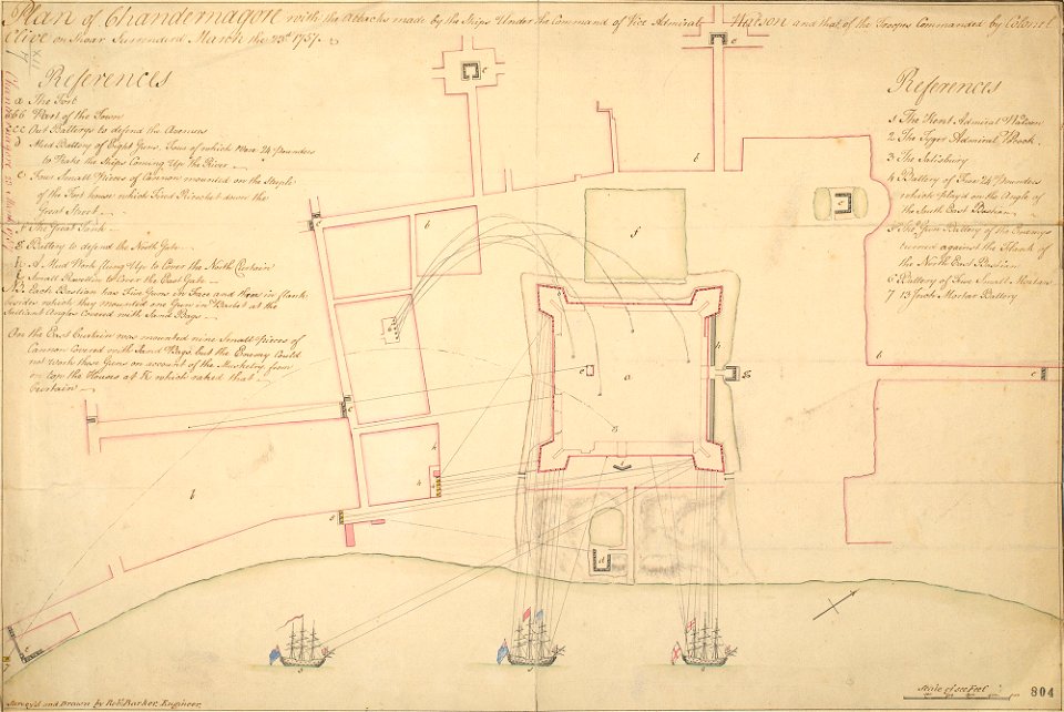
history of the french navy
fort st. george
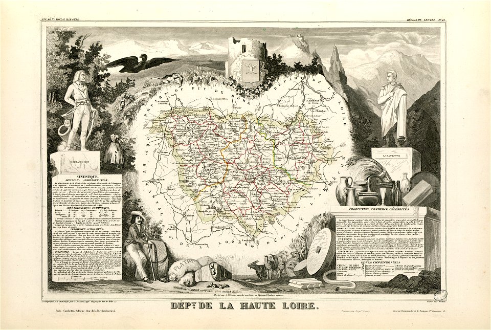
coats of arms of cities in haute-loire
marquis de la fayette
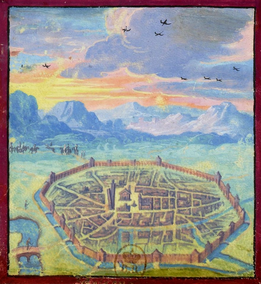
maps and topographical views by joris hoefnagel
crete under venetian rule
maps with cartouches
atlas van der hagen
1853
54
coats of arms of cities in vienne
frédéric-auguste laguillermie
maps made in the 16th century
old maps of lazio
fonds ancely - bibliothèque municipale de toulouse - maps
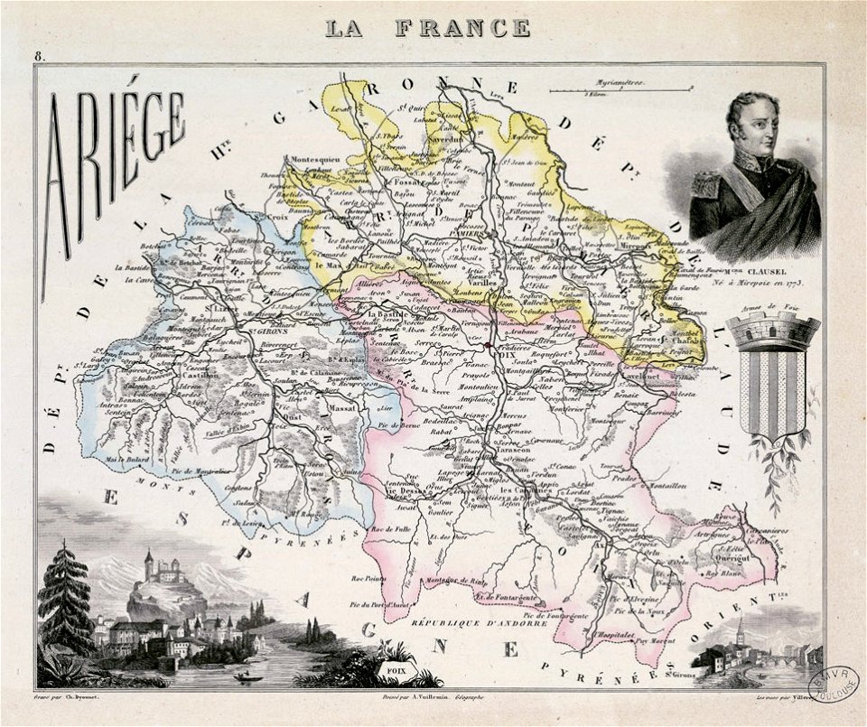
coats of arms of foix
fonds ancely - bibliothèque municipale de toulouse - maps
historical images of biarritz
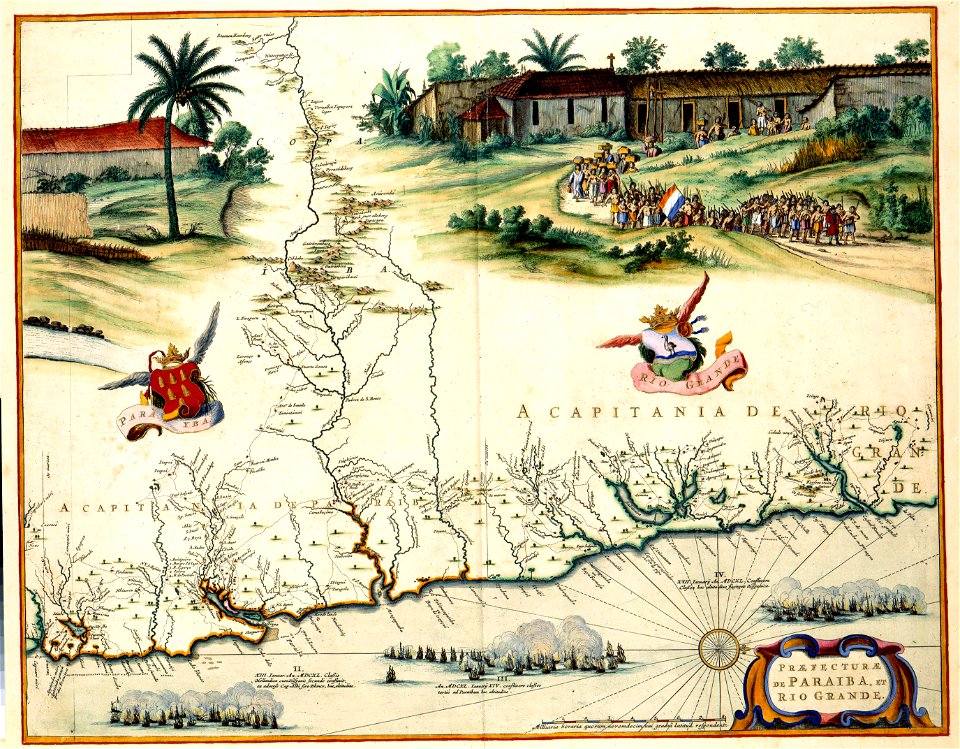
1780 in south america
1780 maps
cornell university library
abolitionism
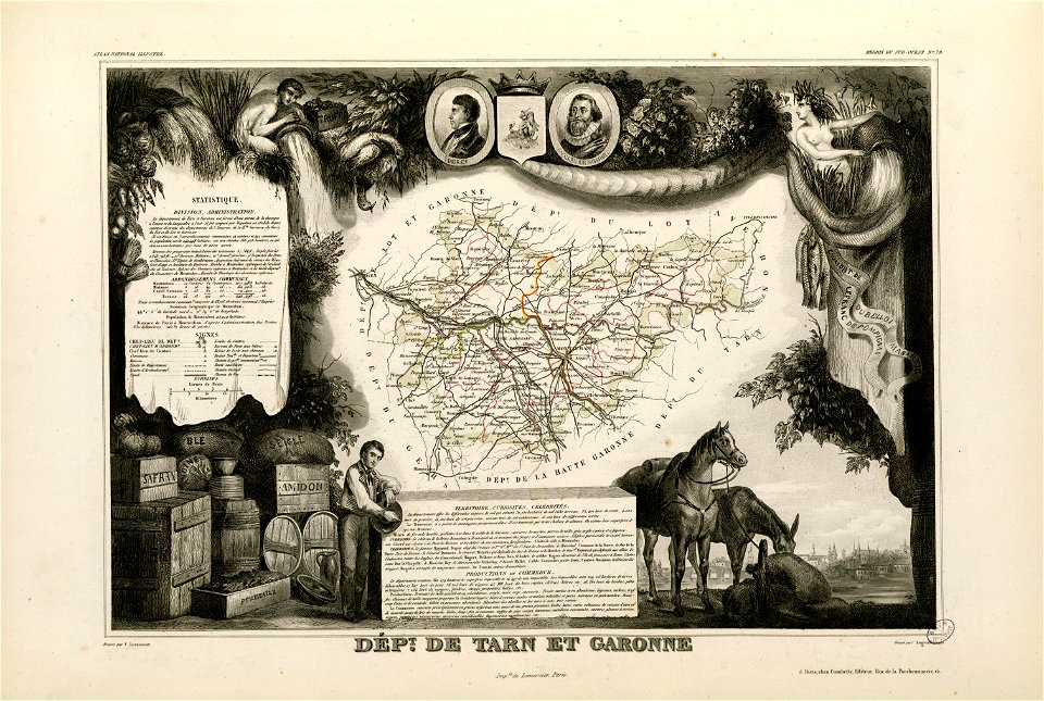
coats of arms of cities in lot-et-garonne
bernard germain de lacépède
maps in the rijksmuseum amsterdam
old maps of valletta
earth
maps
4101 - 4200 of 11,660
Next page
/ 117